An Overview of the Ongoing Space Platform and System Projects in Turkey
Reconnaissance and Surveillance Satellite System (GOKTURK-1)
The GOKTURK-1 Contract was signed between the Italian company Telespazio SPA and the Presidency of Defence Industries on July 16, 2009 and the contract entered into force on July 19, 2010. The project includes; a satellite with an electro-optical (EO) payload, Main Ground Station, Mobile Backup Ground Station and the installation of TAI (now Turkish Aerospace Industries) Space Systems Assembly Integration and Test Center (USET/AIT) to be established on Turkish Aerospace Industries’ premises. The satellite is capable of collecting images in Panchromatic (PAN, black and white) at a 0.5m spatial resolution, and 4-band Multispectral (MS, full color) at a 2m spatial resolution, was the highest resolution satellite system procured on international market at that time.
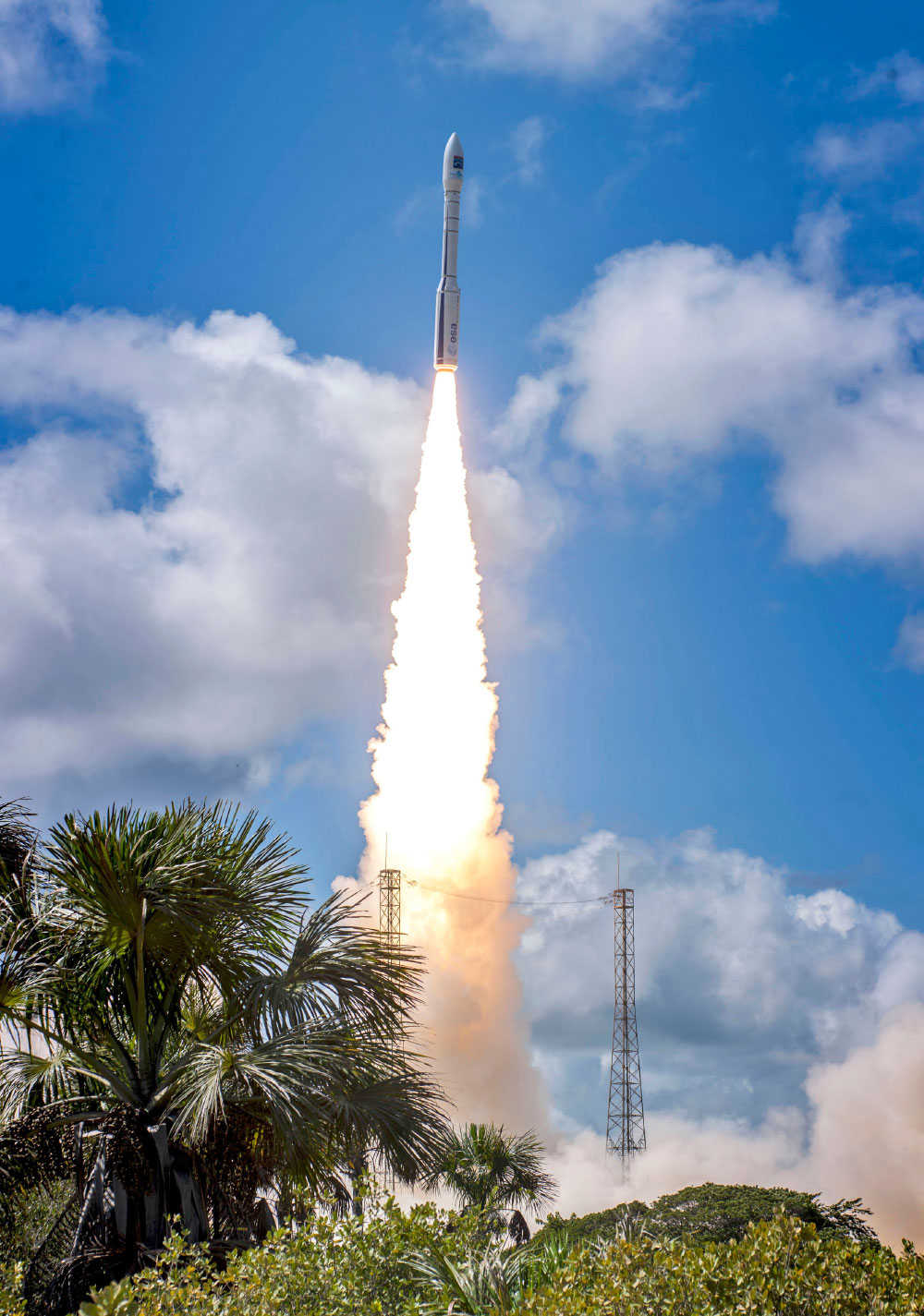
The GOKTURK-1 Electro-Optical (EO) Reconnaissance and Surveillance Satellite, capable of collecting very high-resolution images (the image resolution of Satellites is defined as ground sampling distance and Satellites with a resolution of one meter and below are classified as high-resolution satellites) with a resolution of 50cm from any region on Earth without any geographical restriction, was sent into orbit on December 5, 2016, with the Vega Satellite Launch Vehicle (SLV) by Arianespace, from the Guyana Space Center in Kourou, in accordance with the agreement signed between the main contractor Telespazio and Arianespace in June 2013.
Following the necessary test activities for the in-orbit acceptance process of the very high-resolution GOKTURK-1 Satellite, the tasking activities were carried out by the Turkish Air Force (TurAF)’s Reconnaissance Satellite Battalion Command in Ahlatlibel/Ankara.
The aim of the Project is to provide solutions for the needs of many civilian activities such as forest control, tracking illegal construction, rapid assessment of damage after natural disasters, determination of agricultural boundaries and geographical data gathering, in addition to collecting very high-resolution images for military intelligence purposes.
Thales Alenia Space France (TAS-F) company, the main Subcontractor, was responsible for the development, and installation and integration activities of the space segment, Telespazio (TPZ), the main contractor, carried out equipment level procurement, production, integration, test and validation activities for the ground segment. Turkish companies Aselsan (Satellite Communication, Ground Station, User & Satellite Access Subsystem), Roketsan (Propulsion System), Turkish Aerospace Industries (Local Main Subcontractor) and TUBITAK BILGEM (Crypto) also participated in the project. Turkish Aerospace Industries, which is directly involved in many work packages, also produced satellite structural panels equipped with three thermal control components. The Ahlatlibel Fixed Ground Station and Mobile Ground Station Subsystem Integration activities were carried out with the active participation of Turkish Aerospace Industries and Aselsan.
The development, manufacturing, and test activities of the GOKTURK-1 Satellite were initiated by the company TAS on July 19, 2010, and it was brought to Turkey on May 7, 2015, following its tests in Cannes, France and placed at the AIT Center which was opened on May 21, 2015. The GOKTURK-1 Satellite has a domestic contribution rate of 20%, and since June 2015 it has been subjected to electrical and functional tests in accordance with the environmental conditions in space, under the responsibility of the Main Contractor TPZ with the participation of Turkish Aerospace Industries and Roketsan personnel. In this context, Mass Property Measurement Tests, Launcher Compatibility and System Level Functional Tests coupled with Environmental Tests such as Acoustic, Shock, Vibration, Thermal Vacuum, Electromagnetic Compatibility (EMC) and Deployment of Solar Arrays which were carried out at AIT Center. The GOKTURK-1 Satellite was sent from Turkish Aerospace Industries facilities with a Cargo Plane to French Guiana, where the launch took place, and reached the Guyana Space Center in Kourou on October 24, 2016. Following necessary preliminary work, refueling of GOKTURK-1, which was placed inside the fairings of the AVUM Module, the fourth stage of Vega SLV, was completed on November 9 then transported to the launch site on November 22, and integration of the Satellite to the 30m-long Vega SLV was carried out on November 23. SSB and TurAF personnel were present and witnessed the entire launch operation at the Guyana Space Center in Kourou.
The wet mass of GOKTURK-1 is approximately 1,000kg and the satellite measures 4.2m x 2.5m x 1.6m, featuring a pair of solar panels and a very high-resolution payload. The GOKTURK-1Satellite was lofted in a Sun-synchronous Polar Low Earth Orbit at an altitude of 689km, circling one complete orbit in 98 minutes, 14 times a day. The service life of GOKTURK-1 is 7 years and the satellite will operate in various imaging modes such as point, strip, wide area and 2-point stereo. While elevation information can be obtained with stereo imaging, the image width will be 15km in point imaging and the strip length will be 780km in strip area imaging.
The GOKTURK-1 Satellite has the capability to collect images in East-West and North-South directions.
USET/AIT (Assembly Integration and Test) Center
One of the most important achievements of the GOKTURK-1 Project is the establishment of the TUSAS Space Systems Assembly Integration and Test Center (AIT), which is one of the major infrastructures in the region. The management responsibility belongs to Turkish Aerospace Industries by the agreement signed between TAI and the SSB. The establishment cost was covered by the Presidency of Defence Industries (40%) and the Ministry of Transport and Infrastructure - Türksat Company. (60%).
The AIT Center, one of Europe’s largest and Turkey’s biggest satellite test facility, was opened by President Recep Tayyip ERDOĞAN on May 21, 2015, at Turkish Aerospace KahramanKazan/Ankara campus.
The foundation of the AIT Center, of which land and infrastructure needs were met by TAI, was laid on October 29, 2011. The Center includes a 9.800m2 closed area and 3,800m2 100,000-Class Clean Room, mechanical, thermal, acoustic and electromagnetic interaction environments. Qualification tests can be performed as conditions will be created exposing satellites to environments that will mirror launch and in-space conditions. In the Center, which is a critical infrastructure for the in-country production of future observation and communication satellites, the assembly, integration and test activities of multiple satellites, up to five tons, can be carried out at the same time and all these activities will be conducted by the expert and trained technical teams of Turkish Aerospace Industries.
Officially accepted in 2017, the AIT Center took part in the conformance and functional tests in accordance with the environmental conditions that the GOKTURK-1 Satellite will encounter in space. The AIT Center consists of a Thermal Vacuum Chamber, Compact Antenna Test Chamber, Acoustic Room, Section for EMC/EMI Electromagnetic Compatibility Tests, Sections with mass and center of mass measurement instruments, vibration system, solar array deployment test and sections where insulation blankets protecting the satellite are manufactured.
GOKTURK-II Satellite
The GOKTURK-2 Satellite, which was developed in order to meet the 2.5m resolution satellite image requirements, with an 80% domestic contribution in terms of engineering and 40% in parts/hardware, was indigenously designed by TUBITAK Space Technologies Research Institute (%51) and Turkish Aerospace Inc. (%49).
The satellite hosts a payload developed by Satrec Initiative (SI) of South Korea, collecting images in Panchromatic at a 2.5m resolution and 4-band Multispectral at a 5m resolution, and additionally a Near Infrared (NIR) Satellite Camera named KUZGUN, domestically developed by TUBITAK Space Technologies Research Institute, with a 20m SWIR (Short Wave Infrared) resolution.
The GOKTURK-2 Satellite, which is controlled from Satellite Ground Station in Ahlatlibel, started to serve the TurAF in a fully operational capacity in April 2013, collecting images from any part of the world without restrictions.
The GOKTURK-2 measuring 1.9m x 1.9m x 1.9m is set at a sun-synchronous orbit at a distance of 686 kilometers from the ground and completes one orbit (the satellite passes from the southernmost to the northernmost point of Turkey in 80 seconds) around the earth every 98 minutes. The GOKTURK-2 Satellite contains high-speed data communication capabilities and can download an image strip of approximately 640km in one pass. It has a dry mass of approximately 409kg and a wet mass of 450kg. The GOKTURK-2 cycles around the earth from the poles 14/15 times a day and makes contact with the Ground Station day and night for 40 minutes each contact and has an average revisit time of 2.5 days.
The GOKTURK-2 National Reconnaissance and Surveillance Satellite is under the command & control of the TurAF and has been operating in orbit for about the last seven years. The satellite has a design life of five years and completed its fifth year in orbit on on December 18, 2017 and it has been successfully continuing its mission as of July 2019.
Aperture Radar (SAR) Satellite System
The GOKTURK-3 Project, which aims to develop space-based imaging capability in any weather condition, day and night, by means of tan Synthetic Aperture Radar (SAR) sensor, consists of the domestic procurement of a high-resolution SAR Reconnaissance and Surveillance Satellite and mobile and fixed ground stations.
In January 2013 at the Defence Industry Executive Committee (SSİK/DIEC) Meeting; it was decided to initiate contract negotiations with Turkish Aerospace Industries for the development of the GOKTURK-3 Satellite Project, which will have SAR imaging capability, with the support of TUBITAK Space Technologies Research Institute and Aselsan and as a result of the intensive studies carried out in this direction, the contract negotiations were completed and the GOKTURK-3 SAR Satellite System Development Project Pre-Design Agreement (Phase 1) was signed between the SSB and Turkish Aerospace Industries in May of 2013 during IDEF 13. Phase 1 of the project was completed in May 2016. Currently, studies are being carried out for the detailed design, manufacturing, testing, launching and in-orbit delivery of the GOKTURK-III (Phase I) Satellite as part of Phase 1, and Phase II of the Project will cover the insurance processes of satellite and the launching and development of the ground segment. Following the signing of the contract, it is expected that the GOKTURK-III Satellite test and launch calendar will be clarified.
The GOKTURK-III SAR Satellite, equipped with an AESA antenna, is planned to be launched into space in 2019 and to be placed in a Sun-synchronous orbit at an altitude around 500km. The Aselsan Radar Systems Roadmap date indicated a date after 2020 for the GOKTURK-III SAR Satellite. The GOKTURK-III Satellite is expected to be sent into space in 2021.
GOKTURK Replacement Satellites
Within the scope of the GOKTURK Replacement Satellites Project that launched with the decision taken at the DIEC Meeting on May 6, 2014, the SSB was authorized to start contract negotiations with TUSAS for the Pre-Design Phase. According to the information we have obtained, the project includes the production of satellites for reconnaissance and surveillance, which will continue as GOKTURK-4/5/6...
In this context, the GOKTURK-IV EO Reconnaissance & Surveillance Satellite, which will replace the GOKTURK-I EO Satellite, will be manufactured at the AIT Center at TUSAS facilities. The GOKTURK-IV Satellite will be designed and manufactured with domestic resources and capabilities and will be equipped with a sub-meter resolution EO camera and is planned to be launched into space a year before the GOKTURK-I Satellite completes its mission in orbit, so that the two satellites can operate together for a year. Subsequently, the following replacement satellite after the GOKTURK Replacement Satellite will also follow suit in this way.
IMECE Sub-Systems Project
IMECE Sub-Systems Project, which aims to develop sub-systems for High-Resolution Earth Observation Satellites in our country and to create the necessary R&D integration and test infrastructures for this purpose, was initiated under the coordination of the Ministry of National Defence (MSB) Department of R&D and Technology (the MSB and the SSB R&D Departments merged under the SSB Department of R&D and Technology Management) and the duration of the signed contract was announced as December 27, 2013 - January 2019.
Earth Observation Satellite Development (IMECE) Project
The IMECE Project Agreement, which was funded by the TUBITAK 1007 Program, was signed on December 21, 2016 between the SSB, TUBITAK, and the TUBITAK Space Technologies Research Institute. The project aims to ensure the continuity of the skills acquired with the GOKTURK Projects in the domestic space/satellite field, to provide space qualification for the indigenously designed satellite systems and subsystems to be developed and to reduce the dependency on international markets.
The IMECE Satellite, to be designed and manufactured entirely by Turkish technicians and engineers and sent into space in 2021, will be inserted into a Sun-Synchronous orbit at an altitude of 680km and will collect Panchromatic images at a 90cm resolution and full color images at a 3.6-meter resolution. The satellite is intended to have high-speed data communication (DC)and will be capable of downloading approximately a 1,000km image strip in a single pass.
The high-resolution EO Satellite Camera, which is currently being developed by TUBITAK Space Optical Systems Research Laboratory (OPMER) for the high-resolution IMECE Satellite. The High Definition Satellite Camera features a diffraction limited Korsch type optical/telescope architecture. The national EO satellite camera is equipped with CMOS TDI image sensors. With the TDI feature, the image of a point on the earth can be collected from multiple pixels which increases the signal/noise ratio of the image. Since the satellite’s orbital speed of ~ 7.5 km/s does not provide sufficient exposure time, TDI is required for high-resolution satellite cameras. The CMOS TDI sensor being developed is expected to be an alternative to the commonly used CCD TDI technology in observation satellites.
TUBITAK Space Technologies Research Institute is carrying out the design, analysis, manufacturing, and testing of the IMECE Satellite and all sub-systems including the onboard computer and power supply of the satellite, within the country. The Turkish Aerospace AIT Center is supposed to be used for satellite environmental tests.
The Solar Panels developed by the TUBITAK Marmara Research Center (MAM) and the Lithium-Ion batteries to be developed by TUBITAK Energy Institute for the first time in Turkey, will become space-qualified on the IMECE satellite and therefore foreign dependency will be eliminated.
A highly efficient Space Qualified Solar Cell developed by Gazi University will be used in the Solar Panel to be used as the experimental payload of the IMECE satellite. The Particle Radiation Test Infrastructure to be established by Middle East Technical University will be one of the important infrastructures meeting the test requirements for developing space qualified materials. The Sub-systems to be developed within the scope of IMECE Sub-System Projects will be designed to meet future satellite needs. Therefore, Turkey will take its place among the few countries producing technology in space with national resources. Although, the IMECE Satellite was planned to be launched into space and become operational in 2020, a delay in this schedule is expected.
TAF Satellite Communication System (TUMSIS) Project and National Military Satellite Communication System (MAHU/TURKSAT-6M)
In addition to the reconnaissance and surveillance satellites, the TAF also makes use of the TURKSAT series dual-use communication satellites. The Turkish Armed Forces X-Band Satellite Communication System using electronic warfare (EW) protected X-Band transponders belong to the TAF on TURKSAT-4A Satellite.
According to the MSB 2017 Annual Report, X-Band transponders are planned to be installed on the TURKSAT-5B Satellite and the TURKSAT-6A Satellite. However, according to the press release issued after the signing ceremony of the satellites to be produced by Airbus Defence & Space (ADS) on November 9, 2017, the TURKSAT-5B weighs in at 4,500kg and is scheduled to be placed in its orbit in 2021, will be a broadband satellite operating in Ku and Ka-bands. Among the communication satellites currently operational, the TURKSAT-3A hosts Ku-Band, the TURKSAT-4A hosts X-Band and Ka-Band, and the TURKSAT-4B hosts C-Band, Ku-Band and Ka-Band transponders. New communication satellites to be placed in orbit in 2020, the TURKSAT-5A weighing 3.500kg will host Ku-Band, TURKSAT-5B will host X-Band, Ku-Band and Ka-Band, and the TURKSAT-6A will host X-Band and Ku-Band transponders. The design and production activities of the TURKSAT-5A and the TURKSAT-5B satellites are currently underway at ADS facilities in France and England, in accordance with the schedule and the Critical Design Review Phase of both satellites has been completed.
The increasing military communication needs of the TAF will be met through both the TURKSAT-6A Satellite and the National Military Communication Satellite, which will be designed and manufactured with national resources and will include X/UHF/Ka-Band transponders. Indigenous products have been developed for the mission payload of the satellite, and these products will also be used in military communication payloads. For the satellite platform and other subsystems, the plan is to use the expertise acquired within the scope of the TURKSAT-6A. In this context, for example, Turkish Aerospace plans to use the satellite platform developed in the TURKSAT-6A Project for the next military communication satellites and conducts its studies in this direction.
The contract of the TSK X-Band Satellite Communication System was signed with Aselsan in December 2013, and it is an IP based system to be operated in accordance with today’s conditions. The system covers both space and ground segments. Studies related to the space segment are being conducted according to the calendar of the TURKSAT-6A Satellite, which will host the mission payload, and the delivery activities as part of the work on the ground segment which are scheduled to start in 2020. Within the scope of the Project consisting of indigenous units nationally developed by local sub-contractors, there are ground stations on various platforms including main and backup control centers for the command & control of the stations.
According to the Aselsan 2017 Annual Report; Aselsan is responsible for the design, manufacturing, functional and environmental testing, transportation to the platform manufacturer, providing technical support for satellite integration activities to be performed by the platform manufacturer, and conducting the in-orbit tests of one X-Band Satellite Communications Mission Payload by utilizing national resources and infrastructure, in order to meet the TAF Satellite Communication requirements. The design activities of the Frequency Down-Convertor (DOCON), Channel Amplifier (CAMP) and Harmonic Filter instruments, are being developed and tested by the company and continue in 2019.
Space segment requirements of the TAF Ku-Band Satellite Communication System Project, which was initiated to provide voice, fax and data communication services to TAF units, which are not connected by TAFICS and Turk Telekom Inc. infrastructure, are met by band leasing through the TURKSAT-3A and the TURKSAT-4B Satellites. Within the scope of the project, for the ground segment there are various type of portable and ship satellite terminals, including main and backup control centers for the command & control of the stations. The deliveries of satellite terminals and the satellite communication control centers, which provide a secure communication infrastructure for the TAF, have been completed and commissioned by the TAF.
TURKSAT-6A National Communication Satellite
The TURKSAT-6A National Communication Satellite will have Ku-Band and X-Band transponders. The TURKSAT-6A National Communication Satellite, with completely national software and design, will be able to perform both commercial and military tasks. The contract for the development and manufacturing of Turkey’s first domestic/national communication satellite TURKSAT-6A was signed on December 15, 2014. Assembly, integration and test activities of the TURKSAT-6A Satellite are being carried out at the Turkish Aerospace AIT Center and the service life of the satellite is estimated to be a minimum of 15 years. The TURKSAT-6A, the first communication satellite of our country which was planned to be ready for launch in December 2020 (and later updated as 2021), is being developed with the partnership model established in accordance with the qualifications of TUBITAK Space, Turkish Aerospace, Aselsan, and CTECH Companies. A total of 342 personnel work on the project under a 72-month schedule.
Aselsan is developing the Ku-Band (commercial/military) and the X-Band (military) communication payload of the satellite, the company also uses composite materials and CFRP/CRP technology to manufacture the shaped reflector antenna (for more efficient power management) of the TURKSAT-6A Satellite, which will provide coverage for Turkey entirely.
The production of the TURKSAT-6A, with a weight of approximately 4,200kg including propellant and a nationally designed and manufactured electric propulsion system, was started with the Project Initiation Meeting that was held on January 29, 2015. The assembly of the Structural-Thermal Qualification Model (STM) of which the durability and the structural systems tested was scheduled to start in December 2017, while testing of the STM was scheduled to start in April 2018. Additionally, the assembly of the Flight Model, which will perform missions in orbit was scheduled to start in 2018. According to the data of the Ministry of Transport and Infrastructure, 41% of the TURKSAT-6A Project as of November 2017 and 47% as of April 2018 have been completed. The studies on the TURKSAT-6A National Communication Satellite, which are expected to be completed within 60 months, are currently underway. The satellite is planned to be placed into an orbit of (Geosynchronous Equatorial Orbit) 42° East in 2021. Within the scope of the project, three different satellite models (Engineering, Structural-Thermal Qualification, and Electrical/Electronic Satellite) will be produced and the fourth satellite model (Flight Model) will be sent into space. Therefore, under the TURKSAT-6A National Communication Satellite Project, four different satellite models will be produced. With the TURKSAT-6A Project Turkey will launch a national satellite into GEO (36.000km) for the first time. The propulsion system developed from the HALE project will be used in the TURKSAT-6A.
National Ground Station Development Project (MIYEG)
The opening meeting of the National Ground Station Development Project (MIYEG) to be realized by TUBITAK Space Technologies Research Institute to develop and provide a national ground station for earth observation satellites which is planned to be launched in the coming years, was held at TUBITAK Space Conference Hall on February 18, 2015. Within the framework of the MIYEG Project to be realized by TUBITAK Space Technologies Research Institute with the coordination of the SSB Department of Air Defence and Space and the incentive of the Ministry of Development, a national Ground Station System capable of communicating in X and S-Bands will be developed. The project is expected to be completed in 2019.
Turkish Aerospace and Small-GEO Communication Satellite
Turkish Aerospace has started feasibility studies for the New Generation Communication Satellite Project, which is called Small-GEO in international terminology. The company aims to offer new-generation communication satellites on the global market through the Small-GEO Project, which will be realized with the experiences obtained from the TURKSAT-6A communication and the GOKTURK earth observation satellites.
Turkish Aerospace aims to accomplish an important project in the field of space systems with a high added value by developing the Small-GEO concept which can meet the needs of domestic and international satellite operators. With the activities to be carried out within the Small-GEO Satellite concept, satellite subsystems will be fully optimized in order to reduce the launch costs by fitting multiple communication satellites into a launch vehicle. Another measure to reduce launch costs would be to equip the satellite with a new generation of electric propulsion systems to reduce the mass sent into space.
The details of Small-GEO Satellite will be determined with the studies to be completed and it is planned to have a weight range of 1 to 2 tons and carry 16 to 24 transponders. The Small-GEO satellite, which will be developed by Turkish Aerospace and equipped with an electric propulsion system, can also be used for military data transfer in addition to civil communication services.
The Small-GEO Satellite is a cost-effective communication satellite concept with a relatively narrow volume configuration, which can meet conventional communication satellite functions such as television broadcast, multimedia applications, mobile and fixed internet access, and secure communication without performance degradation. Small-GEO satellites stand out with their low production and launch costs and high-performance broadcast and communication solutions compared to conventional communication satellites.
ASELSAT Cube Sat Development Project
ASELSAN initiated the ASELSAT 3U Cube Sat Development Project to earn flight heritage for Aselsan’s indigenously developed miniaturized X-Band Transmitter. Aselsan designed X-Band Transmitter will send the optical data, which will be created by ASELSAT’s camera payload (able to be taking pictures at 30m GSD), to the ground station. Also, its secondary payload radiation dosimeters will collect statistical data from the low orbit space for design activities. The main mission of the ASELSAT satellite is to take images and transmit it to a ground station via X-Band Transmitter. Within the scope of the Project the PDR phase was completed in 2018, and as of May 2019, the production and assembly of the ASELSAT 3U Cube Sat Flight Model is ongoing. In February 2019, Aselsan received permission from the Information and Communication Technologies Authority to test the ASELSAT 3U Cube Sat. The ASELSAT 3U Cube Satellite is scheduled to be placed into its orbit in 2019.
Under the ASELSAT 3U Cube Sat Development Project, Istanbul Technical University (ITU) Department of Aerospace Engineering and Atılım University Department of Mechatronics Engineering are working as sub-contractors. The preliminary design phase for the cube satellite platform was developed by ITU Aerospace Engineering team has been completed and the critical design phase studies are in progress. The Critical Design Phase of the Indigenous Reaction Wheel, developed by Atılım University, continues in accordance with the project management plan.
STM Small Satellites LAGARI and PIRISAT
STM, one of the leading companies in the defence industry, exhibited Turkey’s first high-resolution Earth observation micro-class satellite “LAGARI” at the IDEF ‘17 Fair. The LAGARI Satellite will conduct reconnaissance and surveillance missions such as providing tactical images of the field, general mapping, forest & vegetation monitoring and natural disaster monitoring.
The new version of LAGARI, equipped with the selected camera system solution, was displayed at the STM stand during the 3rd Global SatShow, held on November 9-10, 2017. The LAGARI has a new generation high-resolution (PAN <2m, MS <8m resolution) electro-optical (EO) camera with the ability to acquire PAN and multispectral spot/strip images, and it is the first national investment to provide satellite imagery as a complementary system for Turkish space technology. STM has been awarded with “Distruptive Innovator of the Year Award” in the 3rd Global SatShow event.
The satellite, named after Lagari Hasan ÇELEBİ, who is considered to be the first person to perform rocket-powered space flight by many respected institutions and organizations working in the space field, is scheduled to be sent into space in 2020. The LAGARI, weighing 70 kg in the Micro-Satellite category, will be one of the few micro satellites in the world to provide images with the target resolution. Within the scope of the LAGARI New Generation Micro-Earth Observation Satellite Project, a Sub-Contractor agreement was signed with Berlin Space Technologies GmbH and a Launch Service agreement was signed with Antrix Corporation Limited for the satellite to be launched with India’s PSLV rocket. As of May 2019, the EO camera and sub-system manufacturing activities are ongoing.
STM, in addition to the LAGARI New Generation Micro-Earth Observation Satellite Project, also carries out other projects for space systems and applications such as the PIRISAT Nano Satellite Platform for Automatic Identification System Application Project, Satellite Constellation Mission Optimization Tool Development Project and Resolution Enhancement Algorithm Development Project for Electro-Optical Satellite Images.
STM launched the PIRISAT concept in the nanosatellite class, with a size of 6U cubesat (10cm x 20cm x 35cm), during the 3rd Global SatShow on November 9-10, 2017. The main objective of the project is to demonstrate space-based Automatic Identification System application on a Nano satellite platform developed by STM. Ships equipped with AIS receiver, which is a secure means of communication, can transmit detailed information such as ID, call codes, coordinates, route, speed, size, destination port and estimated time of arrival. In this way, it is aimed to provide safer navigation for ships and to allow maritime authorities to monitor marine traffic more accurately.
Another important feature of the PIRISAT is that various electronic components and experimental products to be developed by universities and SMEs will be integrated in the satellite to provide space-qualification to newly developed equipment’s and products. Thus, it will contribute to the development of national space technology.
PIRISAT will have a maximum weight of 10kg which is the limit for 6U cubesat standard and will have the capability to carry 4kg of payload. The satellite is planned to be sent into space in 2020.
Turkey Space Agency Established
Turkey’s official gazette published a Presidential Decree (number 23) on Thursday, December 13, 2018 announcing the establishment of the country’s space agency. The Presidential Decree was signed by the Republic of Turkey’s President Recep Tayyip ERDOĞAN on December 12, 2018.
The Turkey Space Agency (TUA) will report to the Turkish Ministry of Industry and Technology but will coordinate and cooperate with other government ministries and agencies as required in the fulfillment of its mission. The Agency has a mandate from President ERDOĞAN to organize, coordinate, and manage all Turkish space activities, to include research and development, advocacy and education, and international cooperation and representation. The Agency is also charged with ensuring that all national and international laws applying to space are enforced and implemented.
The TUA will prepare and carry out the National Space Program in line with the policies determined by the President of Turkey, according to the decree.
The Agency will have financial and administrative autonomy as well as a special budget and will pave the way for the establishment of a competitive indigenous industry. The agency will also pursue multilateral and bilateral cooperation with its international counterparts while protecting Turkey’s rights at the United Nations.
One strategic purpose of the TUA is to, “reduce external dependence in space and aviation science and technologies, to increase the competitiveness in the international arena, to create scientific and technological infrastructure and to develop new technology.”
“We are forming the Turkish Space Agency in order to strengthen our aerospace industry, improve scientific infrastructure and human resources in the field of space technology and further boost our capacities and abilities,” a Turkish Government spokesperson said.
The TUA will be headquartered in Turkey’s capital city, Ankara